The new version of the MeteoCast® platform — a web-based solution that gathers together all available weather information — marks an important milestone in the company’s range of products and solutions.
A totally new experience that expands the capacity for detailed analysis of weather events and their space-time evolution:
- new graphic interface;
- new user experience and general reorganisation of all available services;
- 3 types of configurations: “Archive”, “Real-time”, “Forecast” to promptly consult the desired information;
- full dataset integration;
- simultaneous display of information from several sources.
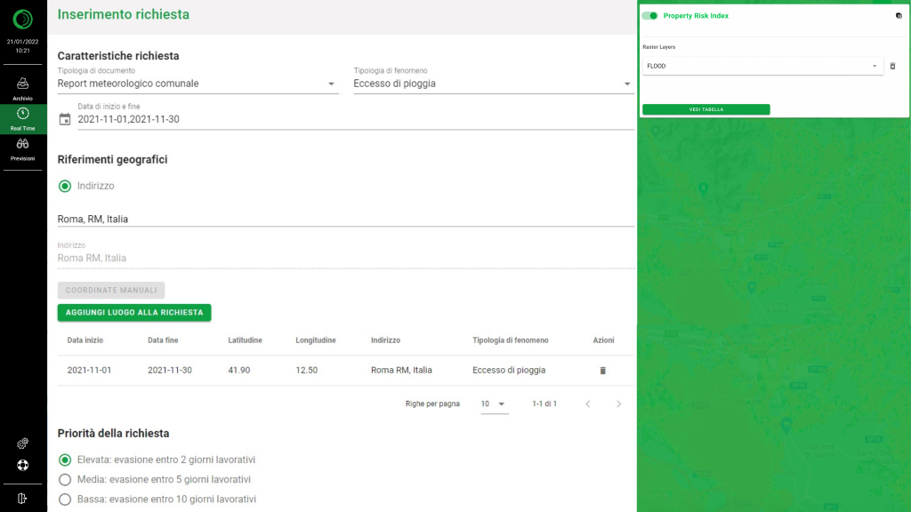
The new MeteoCast® interface enables full customisation of weather data search parameters
This MeteoCast® overhaul — created in response to requests and with direct involvement of Radarmeteo clients, particularly those from the insurance sector — is the expression of a corporate vision geared towards transforming the technological objectives reached into product and service innovations, making them available to the end user
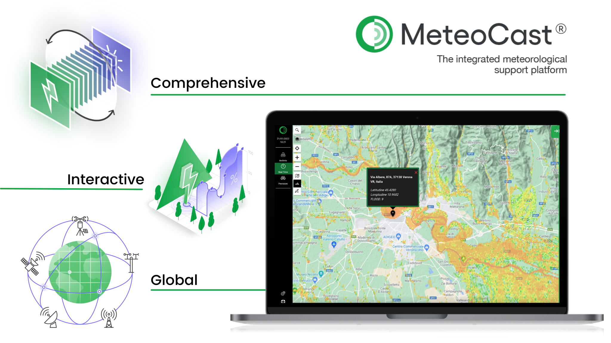
THE MAIN FEATURES OF METEOCAST®
Interactive
Interactive WebGIS system with all data of interest displayed on the same map, without having to flip through pages.
Comprehensive
Enables one to consult all available weather and climate data and, at the same time, easily integrate additional geo-referenced layers of interest.
Global
The platform is multilingual, designed to display data from any point or area on the globe.
An example of the display of overlapping meteorological layers
KEY INNOVATIONS
Now MeteoCast® can also display other data on the GIS, for example:
- risk indicators for hail, rain, strong wind and SWRI (Severe Weather Risk Index, a composite adversity index developed by Hypermeteo), providing the end user with a detailed territorial risk classification based on exposure to adverse weather events;
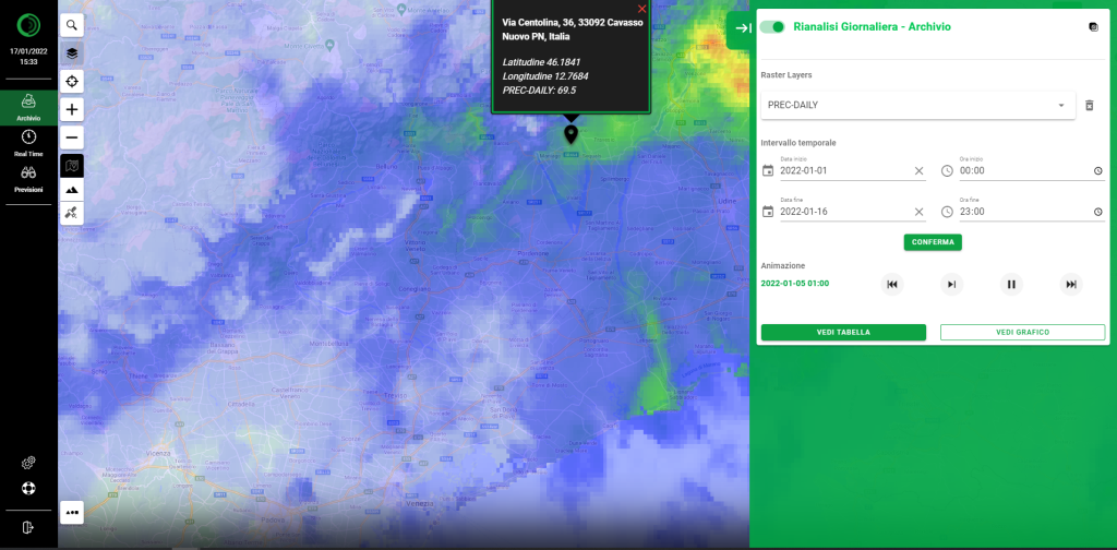
- meteorological reanalysis data for ex-post verification of weather events or analysis of the historical evolution of the parameters of interest;
- 10-day forecasts, useful for the ex-ante analysis of expected events (e.g. for their impact on insurance portfolios);
- integration with any additional geo-referenced information of interest to the user (e.g. maps covering flood, seismic, hydro-geological risks, etc.).
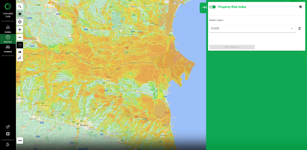
Flood risk index display
RISK MANAGEMENT TOOL UPDATES
The new platform also incorporates developments in the GisMeteotrigger®, Meteotrigger® and Alert Ex-Post® services — the historical support for insurance companies and agricultural associations— used to verify the occurrence of various weather events. The new services are now fully integrated into the MeteoCast® platform, the aim being to optimise the data request management process and reference threshold exceedance consultation.
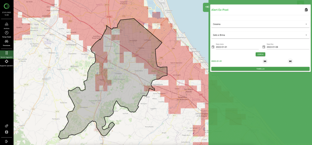
With this platform one can consult the Alert Ex-Post® adverse weather event monitoring service according to specific user-defined thresholds
Comments are closed.